Para obtener la versión en español de este blog, vaya aquí.
OpenStreetMap was founded in 2004, and since then has functioned as a crucial platform to improve the access to data and geographical information on an international scale. The implementation of OSM in different academic subjects has demonstrated how open-source mapping is essential for integrating a spatial approach. To promote usage of OpenStreetMap in the classroom, the TeachOSM project was conceived. Among its main goals are to guide OpenStreetMap incorporation among teachers and students, transfer knowledge and support student mapping activities. For this reason, we want to showcase through a series of blog posts, specific experiences, challenges, specific experiences, and recommendations from teachers to navigate the implementation of OpenStreetMap in your classes.
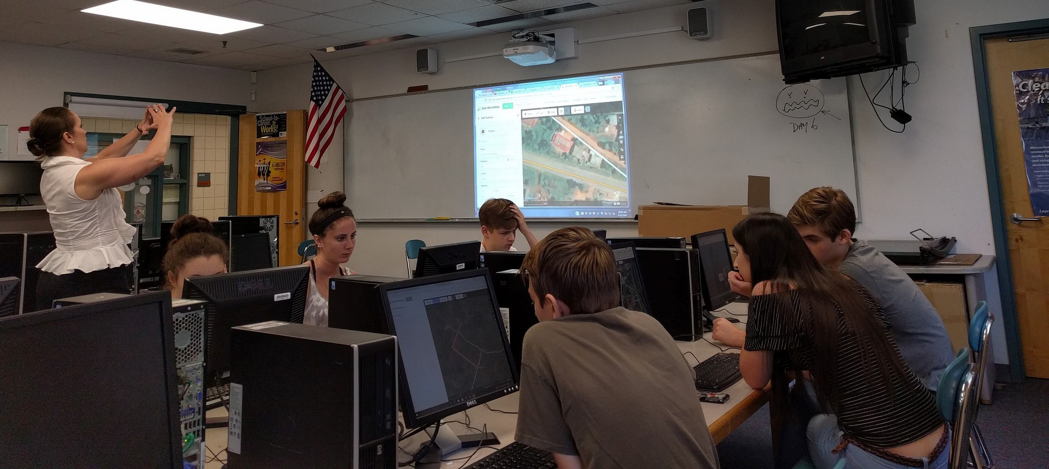
For our first entry, we spoke with Celeste Reynolds, a high school teacher in Massachusetts, USA who, among other subjects, teaches AP Geography, Current Events, and Women’s Studies. She became involved with the OpenStreetMap (OSM) community through the American Geographical Society fellowship. Prior to this introduction, Mrs. Reynolds had no experience in mapping or how it could be used within her work as a teacher. After she became familiar with the TeachOSM project, she began to work with her students. Here we talk about her first project and how it led to a student initiative.
OpenStreetMap in the classroom: innovation and community engagement.
Are maps a tool from the past? Are there no longer elements that need to be mapped? When we think about cartography, maps and its functions, the relevance within the different spheres is not sufficiently widespread. However, Mrs. Reynolds shows students how OpenStreetMap can be used as a tool to understand our reality and contribute to different communities.
The first project she developed with her students was the mapping of refugee camps. Identifying how the refugee camps are part of an ecosystem, with organizations, the country’s actions and how refugees move within these spaces, as well as taking into account what was seen during the classes on conditions and contexts in which refugees migrate, attracted the students’ attention. Thanks to this approach to OSM as an instrument to solve real problems, the students began to be interested in the needs of mapping the world around them. Reynolds comments on how this activity raised many questions, especially what can happen if a space is not represented. Being fragile realities, when students engage in a hands-on way with the circumstances of refugees, they understand how the access to geographic data can connect spaces around the world. It also means placing ourselves in a different environment, understanding that the line we’re mapping represents a road that leads to a refugee center, the square we placed stands for a building that provides services.
After this first experience, mapping places for refugees has become a regular project to present the contents of the course in an interactive way, at the same time that involvement with OSM is promoted, so that students become familiar with the platform. By incorporating OSM in the class participation’s activities, the contents become closer to students’ realities, and contribution is encouraged in initiatives that seek to improve access to data at an international level.
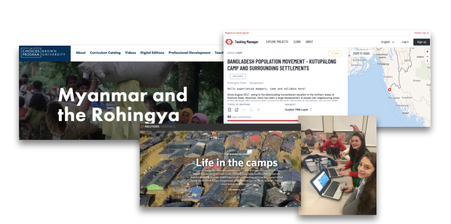
Interested in mapping in support of refugees? Active mapping projects can be found here.
Beyond refugees, how do maps impact peoples’ lives? How can the lack of open geographic information affect in the event of a natural disaster? What does it visually mean that our environment does not appear on a map? Once students start to question how missing geographic data has consequences where we live and how communities will have to cope with drastic changes, mapping activities become driven by the student interest in answering these questions. And as part of the recognition of the immediate environment, Mrs. Reynolds has developed mapping tasks to understand issues closer to home such as food deserts, the United State’s relationship with other countries, and how the rural part of the country is in great need of geographic representation.
Acknowledging difficulties as part of the process.
Celeste Reynolds identifies challenges encountered throughout the process of introducing a new tool. The first, since OSM is a representation of different realities, whoever maps must be careful with the quality of their edits. A connection must be created between what we are creating with OpenStreetMap, be it an area, point or line, and the reality we are displaying. In her words “once we realize that we are not mapping squares / rectangles, and we understand that they are places, the quality of our work improves.” With this new way of understanding OSM, students become more careful when using the platform. Additionally, this attention to detail helps students improve their technical skills.
The second difficulty when carrying out the projects is the way student mapping is evaluated within the classes. Being a relatively new tool, ways to assess performance are still being sought. On this, Celeste Reynolds recommends counting OSM’s activities as part of the class participation. Thanks to the resources that the community has developed, like OSMCha, teachers can track the number of changes, what students have worked on, and the quality can be traced. This encourages constant mapping, by being able to generate rankings of editions.
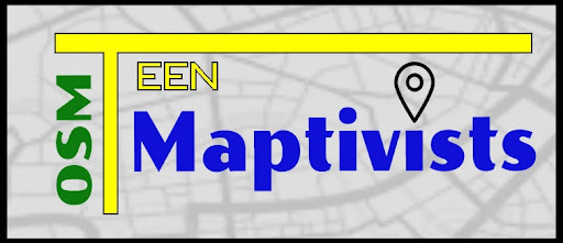
TeenMaptivists: a commitment from young people.
Despite the obstacles that arose with the introduction of a new tool, the students developed a strong enthusiasm for OpenStreetMap. The student initiative, OSM TeenMaptivists emerged during the pandemic as a need for students to get directly involved and support their local communities. From the desire to help locally, they identified that they could map businesses that helped those who needed it with services or resources. Once again, as a virtual tool, OSM allowed students to apply their knowledge inside and outside of the classroom.
Currently, through in-person classes students continue organizing to improve their mapping techniques. As part of the activities they carry out to keep the group active are the monthly virtual Mapathons with guest speakers that have experience within the OSM community to share their knowledge. These spaces allow students to think of new ways to apply mapping in their lives, as well as to visualize how they could develop within this industry. In addition, being a student club, they can work as leaders within their communities.
Finally, Mrs. Reynolds highlights how TeachOSM creates a bridge of knowledge and exchange, between teachers and students, which allows young people to be involved from an early age in free mapping with community objectives. From participating in volunteer projects, through activities with TeenMaptivists, to those who after graduation have found a community in OSM, the work of TeachOSM and teachers is key to rethinking how knowledge is transferred.
Written by Maya Lovo.
Do you have a story to share about how you are using OpenStreetMap in the classroom? Reach out at info@teachosm.org!